


Located in the Far North region of Cameroon, especially in the Diamaré district, Maroua is the capital of the Far North region. Maroua was established as an urban community in 2008 and it is the administrative center of the whole region. The mix populations are composed of several ethnic groups which are organized in traditional communities. Maroua is also known for its imposing ginger fields and its famous ginger liqueur. The People believe that the ginger liquor is good for sexual health and provides “lion power”.
Maroua is also famous for its handicraft, the artisan center gathers about 50 artisans who exhibit daily their products. There are also tanners, potters, weavers, and blacksmiths. In addition to crafts, cotton is an important source of income for the population. The climate is tropical, dry and warm, the average annual temperature is 29 °C and the average annual precipitations are 794 mm.
Rhumsiki

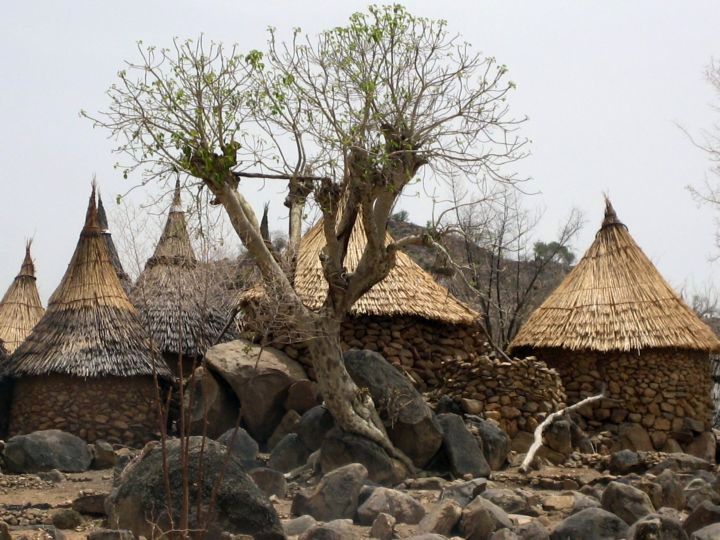
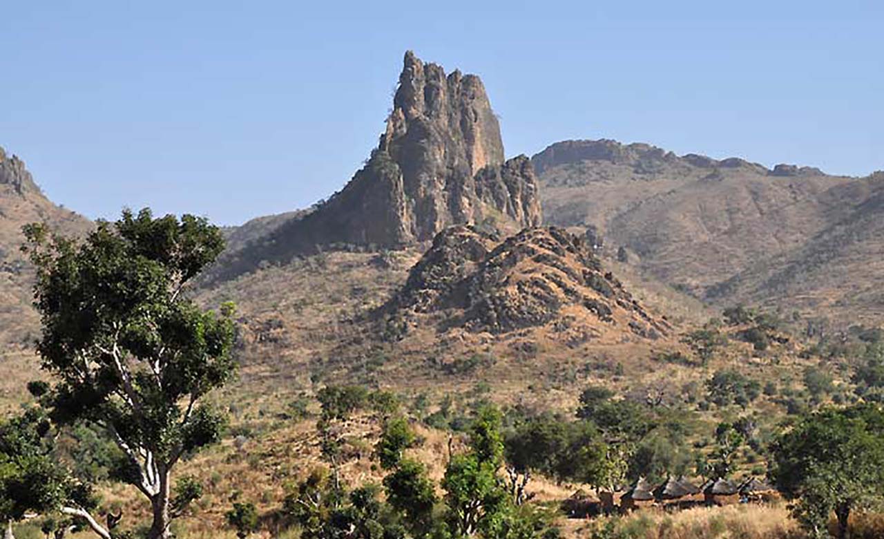
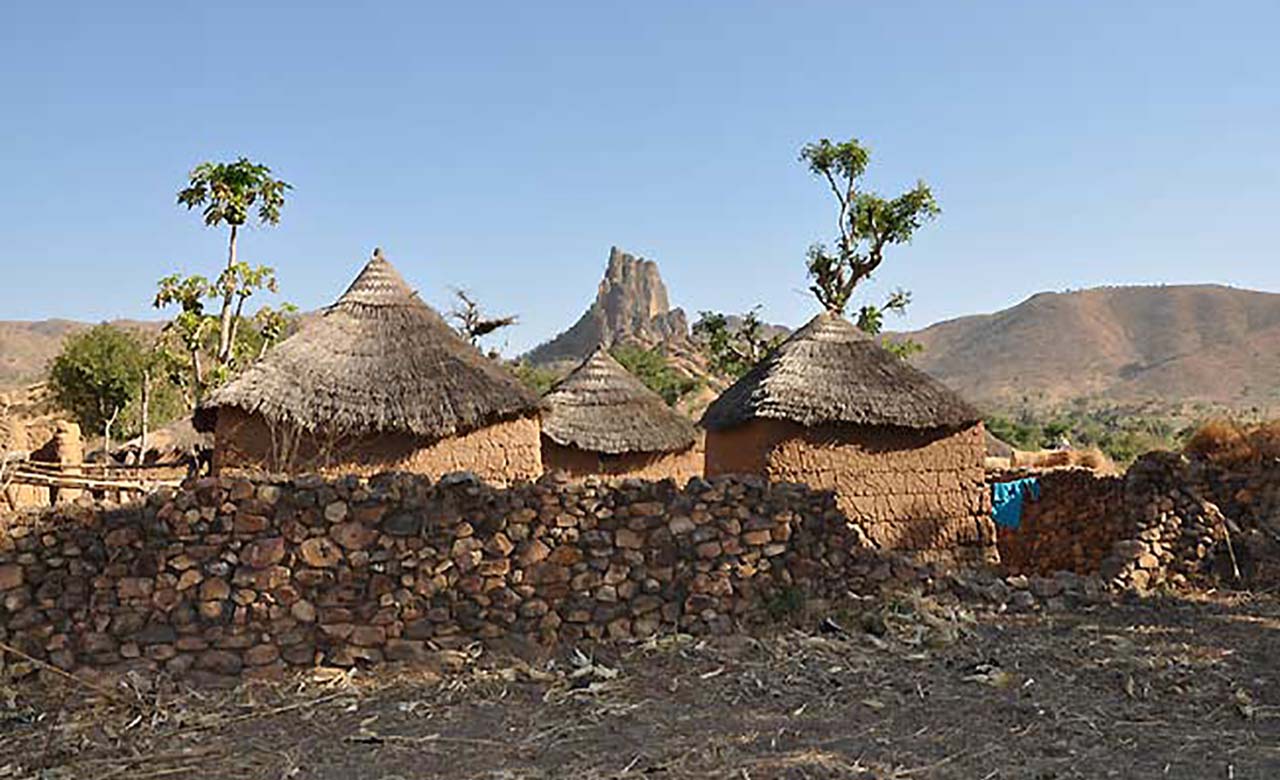
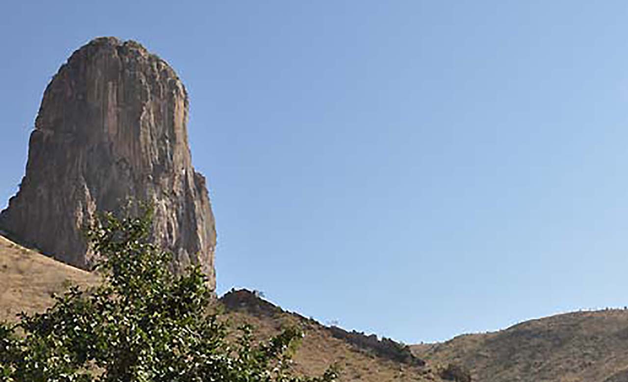
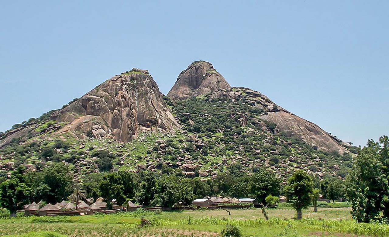
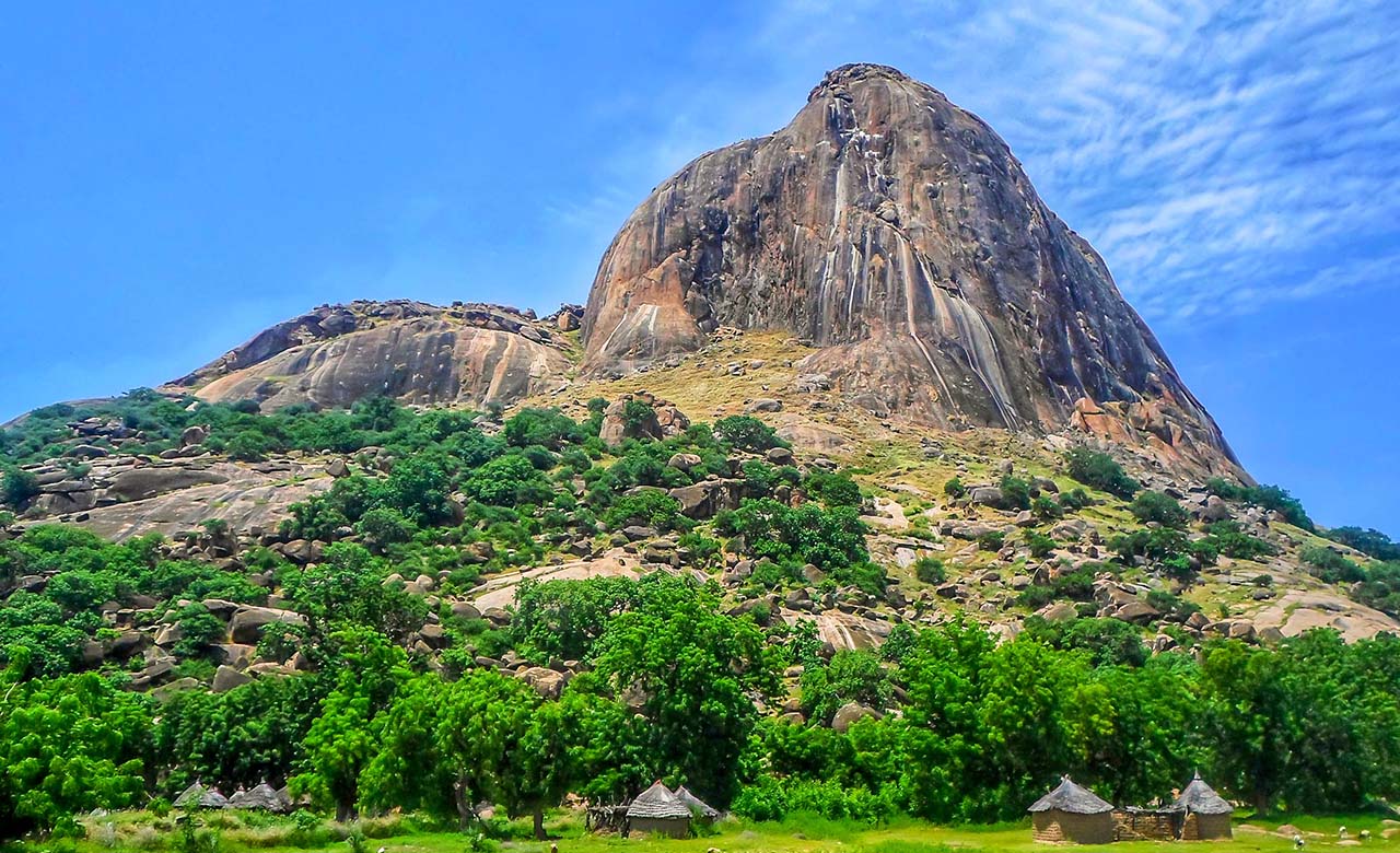
Located in the Far North region, on the border with Nigeria, Rhumsiki (or Roumsiki), is a picturesque village of less than 5,000 inhabitants nestled in the heart of Kapsiki country in the Mandara Mountains. It is a high plateau where huge lava peaks rise as far as the eye can see, coming from volcanic chimneys sometimes reaching more than 1000 m in altitude. The most famous of the rocky needles is that of Mchirgué also known as the peak of Rhumsiki which rises to 1.224 m and which can be admired from the entrance of the
village coming from Mokolo. This unique lunar landscape makes this village one of the high places of Cameroonian tourism and an obligatory stage of all circuits in the Far North. Rhumsiki has adapted to the tourist flow and the children of the village offer themselves as tourist guides thus showing visitors the attractions of the region. It is one of the biggest tourist sites of Cameroon, it is described as “remarkable” “striking” “breathtaking” or as “a lunar landscape”. Writer and explorer André Gide wrote that the landscapes of Rhumsiki are “among the most beautiful landscapes in the world”.
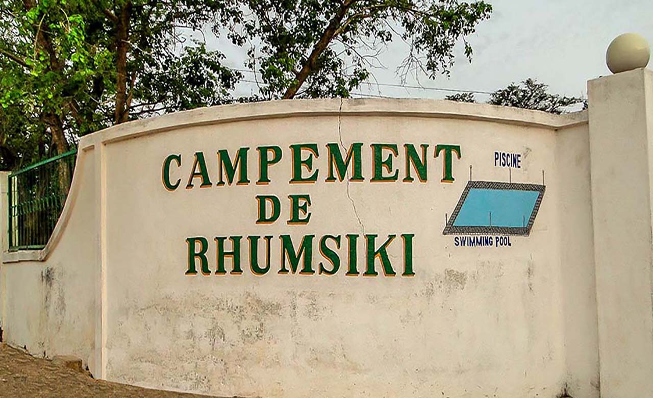
NB: It is preferable to spend the night there in order to make the most of the landscape at sunset and sunrise. Indeed, at sunset as at sunrise, the rocky peaks and the surrounding savannah take on ocher and glowing colors, thus making the landscape even more fascinating. The Rhumsiki camp offers all the necessary comfort with its Boukarous, its restaurant and its swimming pool directly overlooking the needles and the lunar landscape. An old building high up at the entrance to the village offers a magnificent observatory over the landscape.
Origin
According to legend, Rhumsiki was founded by a hunter named Siki, a native of this high plateau. His village being plagued by overpopulation and famine, he chose to go into exile in search of new lands, he discovered a welcoming site and chose to settle there. Shortly after his departure, he was joined by three hunters and their families who were fleeing the Muslim conquerors from the north to forcibly convert the animist Kapsiki. They decided to settle in the present location of Rhumsiki.
The Crab Wizard

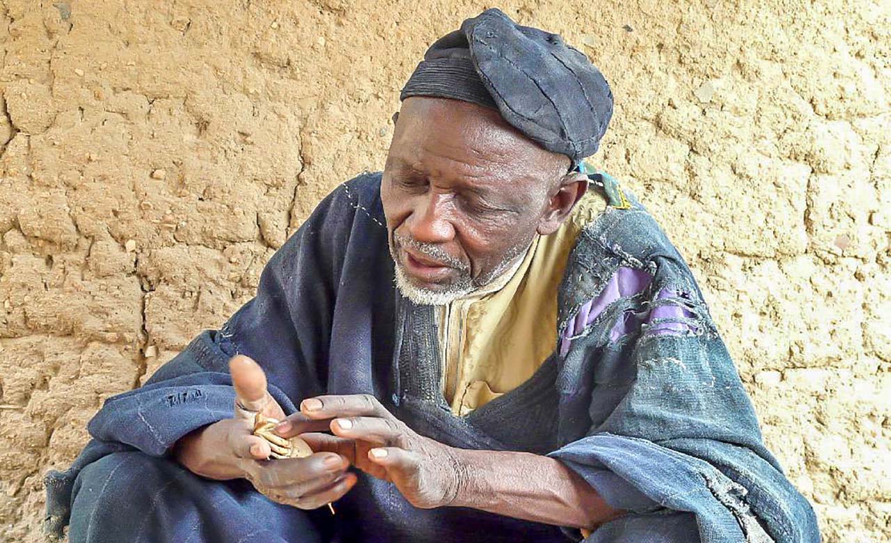
The crab wizard is, without doubt, one of the great tourist attractions in Rhumsiki. He is a blacksmith who predicts the future using crabs. Tourists, residents of Rhumsiki but also of several neighboring villages, usually come early in the morning to consult it in order to know, for example, if the harvests will be good, if a marriage will be successful, if a loved one will recover from a disease or just predict the future. The sorcerer then swirls his crustaceans, placed in the center of a circle of small sticks at the bottom of a clay container
while uttering some incantatory formulas. After a few moments, the wizard stops and he begins to interpret the movement of crabs and sticks …depending on how they have moved, he can predict the future. Visitors will certainly need a translator, as the crab wizard does not speak French or English. For those who would like to take pictures, be sure to ask for his opinion before taking out your camera.
Waza National Park

Located in Far North Region, it was created in 1934 as a hunting reserve and became a national park in 1968. It covers an area of 170,000 hectares and it is since 1979 a UNESCO Biosphere Reserve. The climate is mostly semi-arid as the average annual precipitation is only 700 mm and erratic in its frequency. The rainy months are June to October and the dry season is from November to May. The mean annual temperature is 28 °C. The dominant vegetation is in the transition zone between the Sahel and Sudan
savanna, containing acacia and open Yaéré savannah forests.
Wildlife
The mammal population in the park is one of the largest in central West Africa. There are 30 species of mammals in the park. The prominent fauna species reported inhabiting the park are the lion, African bush elephant, hyena, leopard, hartebeest, tsessebe, olive baboon, patas, vervet monkey, roan antelope, Kob antelope, waterbuck, reed, gazelle, Sudan cheetah, nocturnal aardvark, and West African giraffe.
Avifauna
There are 379 species of birds in the park including the contiguous Logone floodplain; among the birds that have been sighted are marbled duck, ferruginous duck, greater spotted eagle, scissor-tailed kite in grasslands, lesser kestrel, Nubian bustard (Neotis Nuba), quail-plover, herons, Arabian bustard (Ardeotis Arabs), Cattle Egret, Hornbill, various species of storks, Abyssinian roller, North African ostriches, ibis and many more. The identified grassland species of birds are more than 20,000.
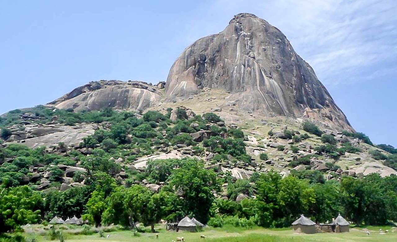
The Mindif’s tooth

The Mindif tooth or Mindif peak, is a rocky peak located 25 kilometers south-east of Maroua, more precisely in the town of Mindif not far from Kaélé. Its altitude is estimated at 769 m and the steep character of the rock and its visibility make its reputation. The ascent of the “peak of Mindif” remains the biggest challenge in Central and West Africa.
The village of Pouss

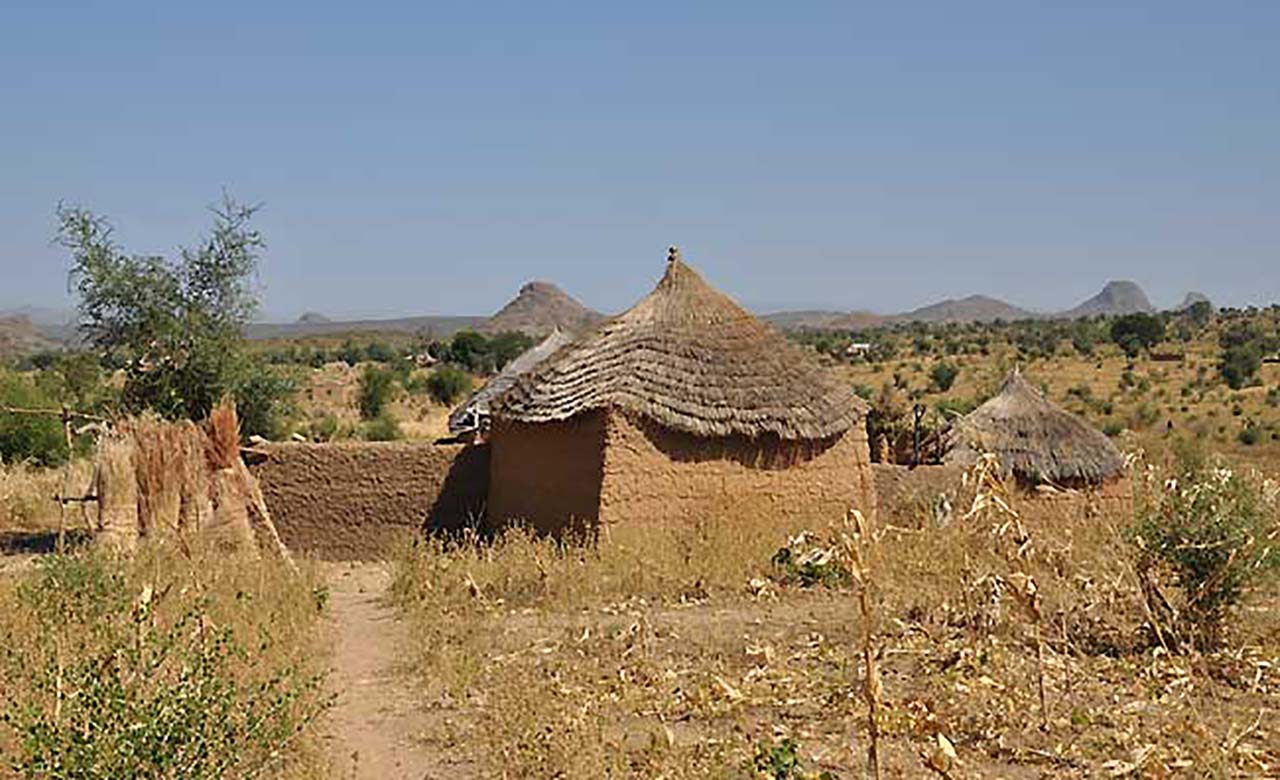
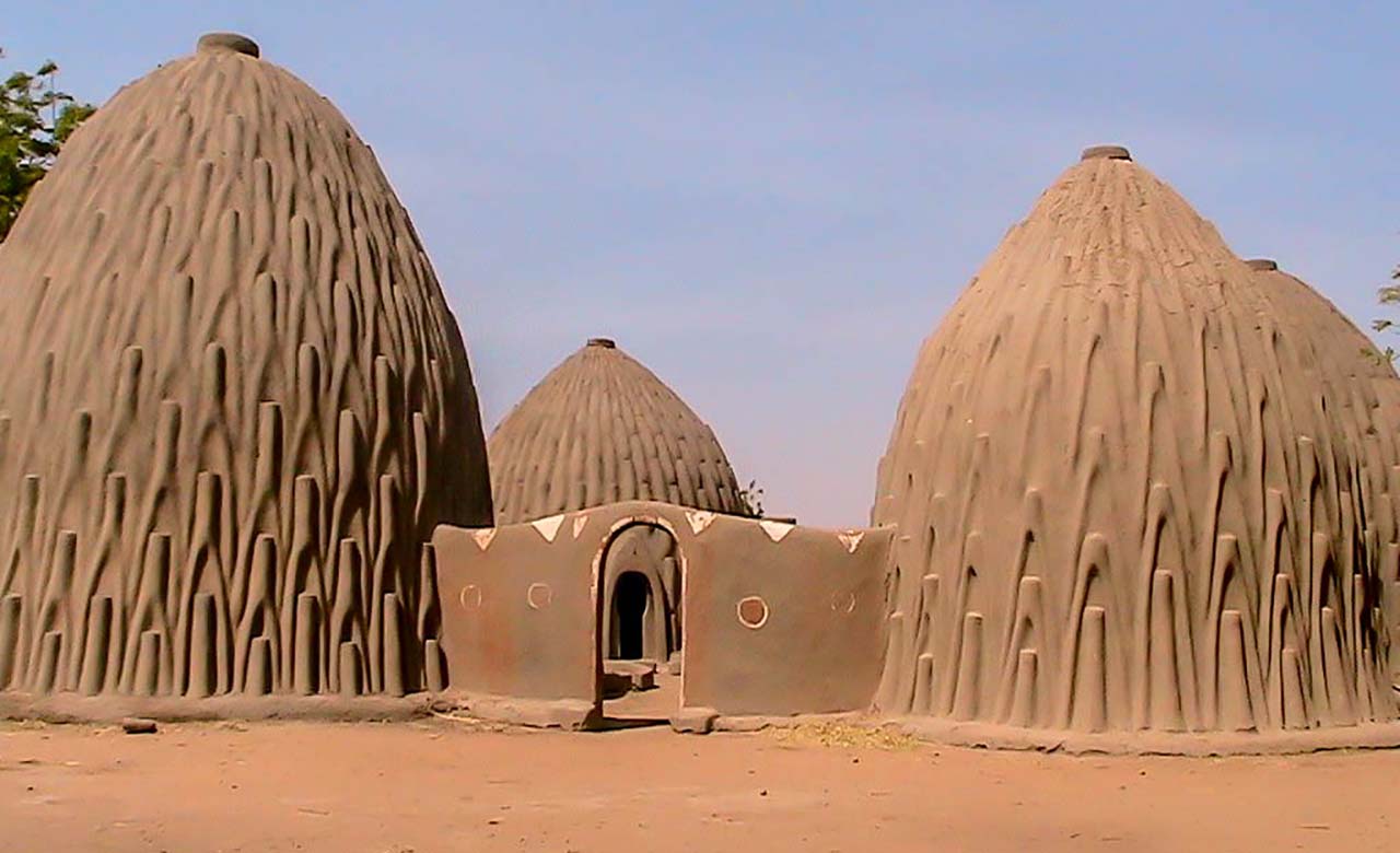
Pouss is a village located in the district of Maga, department of Mayo-Danay, in the Far North Region of Cameroon. This cosmopolitan village is occupied for the most part by the Mousgoum who coexist with other peoples such as the Massa, Kanouri, Choa Arabs, Fulani and many others. It is run by a sultan and it is an essential tourist stopover in the Far North. This picturesque village, with alleys shaded by palm trees, is known for its market and its sultanate, but above all for its famous Mousgoum mud huts. These huts are among the most
beautiful and tallest in Africa, and bear witness to the architectural know-how of the Mousgoum tribe. These magnificent constructions owe their name to their conical, shell-shaped, ribbed with numerous grooves that serve as scaffolding during construction, buttresses and ingenious drainage systems. These huts represent the Mousgoum culture in all its richness and splendor. What is remarkable in this type of typical habitat of the Mousgoum tribe, is the absence of a foundation or framework to support this enormous mass made of a mixture of earth, straw and vegetable glue dried and solidified by the sun. The typical blend is made up of 5 huts, one of which is traditionally reserved for cattle. In the center is usually a huge urn which serves as a granary for millet and which allows the whole family to live.
The Pouss market
The Pouss market is held every Tuesday. It is considered a crossroads because it brings together Chadians, Nigerians and nationals from all over the region. It is one of the largest markets in the Far North region. Very rich, the Pouss market contains various products such as cereals, foodstuffs, handcrafted tools, hunting, agriculture and livestock. Its particularity is that it is large and open in all seasons.
The hippos of Lake Maga

Located in the department of Mayo-Danay, the man-made lake of Maga stretches for almost 25 km. It is supplied by water discharges from the Logone and contributions from Mayo Guerléo, Mayos Boula and Tsanaga, Mandaras Mountains and runoff from its catchment area. Created in 1979, the lake has a capacity of 600 million m³ for an area of 39,000 ha. Lake Maga provides irrigation for the region and allows the cultivation of rice. Particularly full of fish such as carp, catfish, ball fish and captain. The Lake is a privileged place to observe birds
that are estimated at around 20,000, and hippos. To see them more closely there is the possibility of taking a motorized canoe by the lake.
Kalamaloué national Park

Located in the northernmost region, 70 km from Lake Chad, it was created in 1948 and covers an area of 45,000 hectares. The savannahs are in abundance here due to the desert climate. The fauna consists of hippos, elephants, various species of monkeys, gazelles and golden jackals.
Mozogo Gokoro National Park

Unique, it covers an area of 1,260 km² and is considered one of the oldest rainforests in the world. He survived the Ice Age and today looks like a museum of more than 60 million years. It has a beautiful flora and fauna. More than 400 species of trees and many medicinal plants have been identified. It counts more than 300 species of birds, 174 species of reptiles and amphibians and 140 species of fish. Styled like a natural wildlife reserve, there are elephants, buffaloes, antelopes, leopards and chimpanzees and more.
